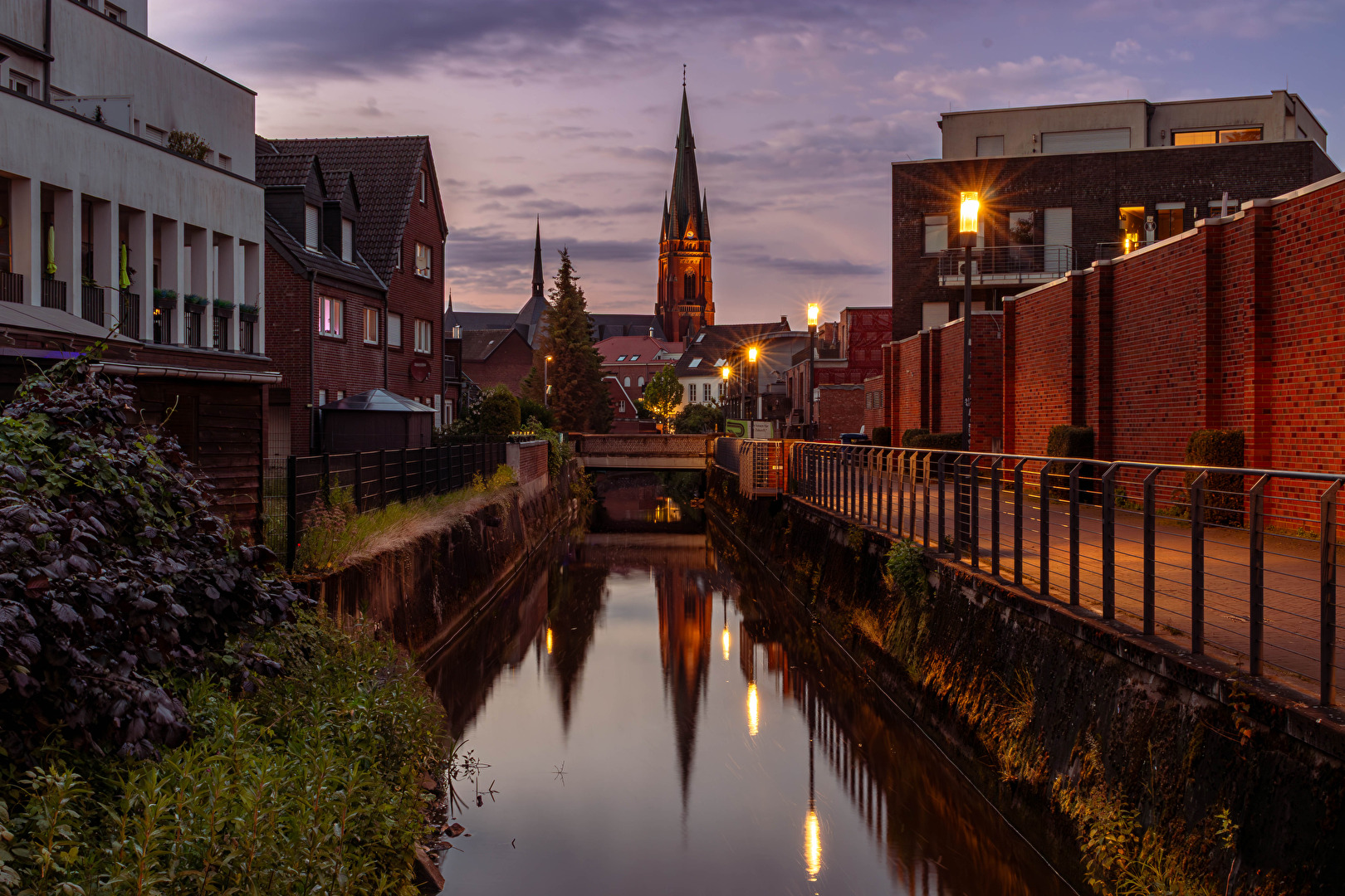
Evening in the CityEvening in the CityAbends in der City
The Rheder Bach originates in the municipality of Borken, in the southern part of the district of Burlo, near the recreational area Klostersee. Within the municipality of the city of Borken, the watercourse is also called Mühlenbach. From the municipal boundary to the city of Rhede, it is exclusively named Rheder Bach. It mostly flows in a northeast-southwest direction, passing through the area belonging to the natural region of the Lower Rhine Sand Plateau. The catchment area is characterized by predominantly sandy to sandy-loamy soils. The source elevation is about 56 meters above sea level, and the mouth into the Bocholter Aa is at around 28 meters above sea level.The Rheder Bach originates in the municipality of Borken, in the southern part of the district of Burlo, near the recreational area Klostersee. Within the municipality of the city of Borken, the watercourse is also called Mühlenbach. From the municipal boundary to the city of Rhede, it is exclusively named Rheder Bach. It mostly flows in a northeast-southwest direction, passing through the area belonging to the natural region of the Lower Rhine Sand Plateau. The catchment area is characterized by predominantly sandy to sandy-loamy soils. The source elevation is about 56 meters above sea level, and the mouth into the Bocholter Aa is at around 28 meters above sea level.Der Rheder Bach entspringt in der Gemeinde Borken, im Süden des Ortsteils Burlo, unweit des Naherholungsgebietes Klostersee. Im Gemeindegebiet der Stadt Borken wird das Gewässer auch Mühlenbach genannt. Ab der Gemeindegrenze zur Stadt Rhede trägt er ausschließlich den Namen Rheder Bach. Er verläuft überwiegend in nordöstlich-südwestlicher Richtung und durchfließt dabei das zum Naturraum der Niederrheinischen Sandplatte gehörende Gebiet. Das Einzugsgebiet ist geprägt von überwiegend sandigen bis sandig-lehmigen Böden. Die Quellhöhe liegt bei etwa 56 m ü. NN, der Mündungsbereich in die Bocholter Aa bei rund 28 m ü. NN.[